Sunday, March 26, 2006

Wagon Mound


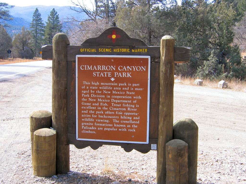
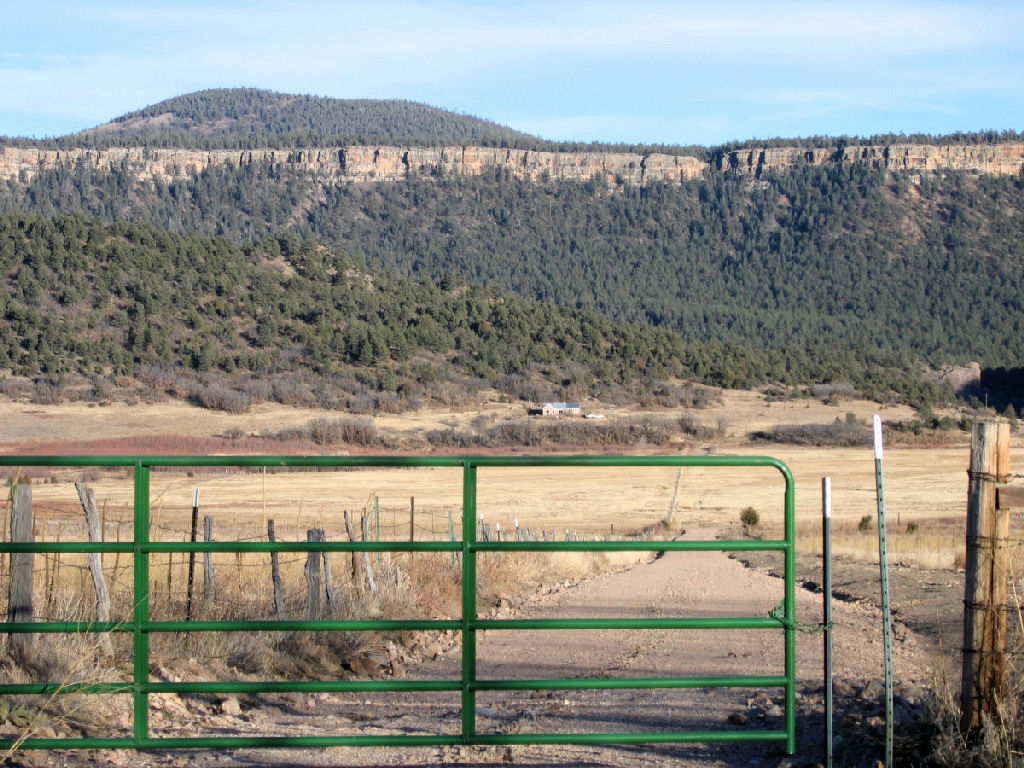
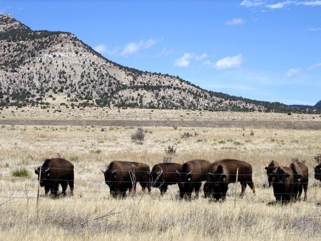
It's a town on the old Sante Fe Trail and a historical site. The town is some 40 miles north of Las Vegas, New Mexico on I25 heading toward Colorado.


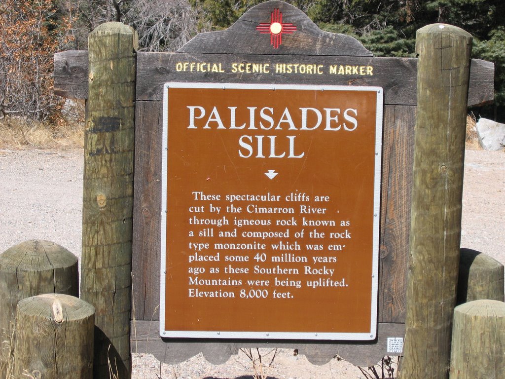
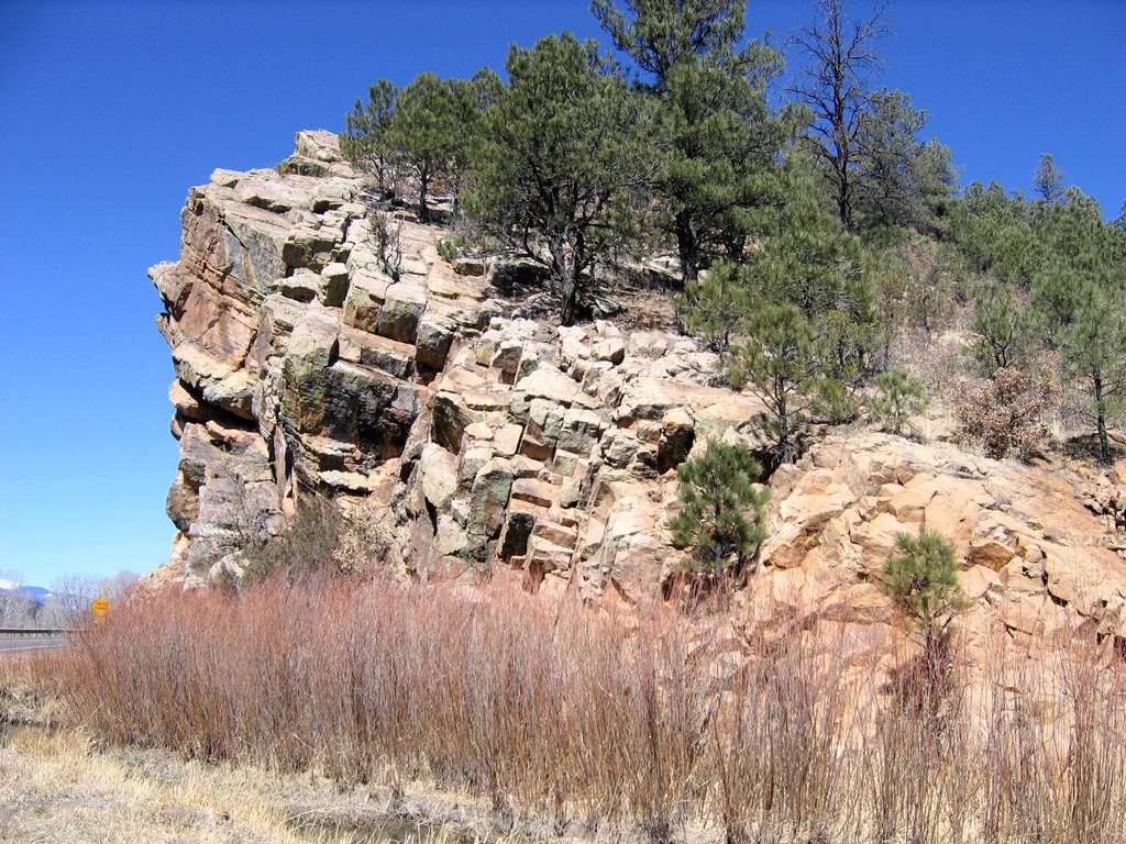
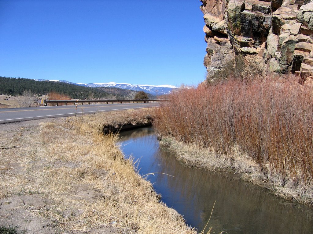
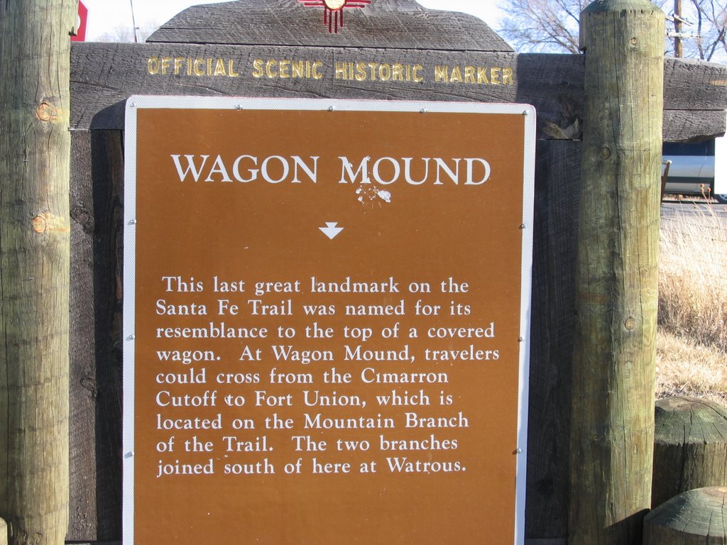
Coming across the high pains, the rock that looks so much like the wagons they were driving, could be seen from many miles away and was a familiarbeacon on the old Trail.

Friday, March 24, 2006

Land is too dry


Gee, I'm falling behind in posting. It's been a busy couple of days.


And, we got some snow. It lasted 24 hours. Not long enough. It lasted through the night but the temperatures warmed up and it was gone in most spots by the next midday.

Wednesday, March 22, 2006

Cimarron Canyon State Park


Driving through the Cimarron Canyon State Park is a grand experience. One really gets the impression that the geological upheavals were quite stressful on the local ecology. The canyon walls are amazing to look at and when driving through there, one really feels small in comparison. I can picture the Indians of the Old West sitting on their horses at the top of one of these canyon walls watching the wagon trains of that time driving though the bottom of the canyon.

Sunday, March 19, 2006

Hermit's Peak


Hermit's peak is visible from most places north of Las Vegas, New Mexico.

It's a very prominent site around here in northern New Mexico. Kind of makes one wonder what kind of geologic upheaval created a monstrous rock such as this and at the same time created the Amola Ridge.

Friday, March 17, 2006

Where Trees Grow


It amazes me to see trees thriving on a rock face. This is the cut to allow Hwy 518 to pass through the Amola Ridge in the La Cueva area.

The Mora River flows under the road to the other side at this point.

Thursday, March 16, 2006

Sangre de Cristos


The taibone of the Rocky Mountains. Storrie Lake is just to the north of Las Vegas, NM on Hwy 518, 25 miles south of Mora. Las Vegas is on the high plains with the mountains to the west. The second picture is Mora [behind the trees] at the bottom of the Mora Valley that I live in. The La Jicaritas [part of the Sangre de Cristos] are to the west.

"The Sangre de Cristo Mountains are one of the longest mountain chains on Earth. They stretch from Poncha Pass, Colorado, in the north to Glorieta Pass, New Mexico, in the south. There are ten peaks over 14,000' high in the range, more than two dozen over 13,000'." From: Sangre de Cristos

Wednesday, March 15, 2006

The Ides of March


Time flies. March 15 early morning surise. Morning Glory!

As a minimum, be sure you have Adaware, SpywareBlaster, and SpyBot Search & Destroy loaded if you are running Windows. The hackers and spammers have ganged up on the rest of us and they use viruses and trojans to infect our machines.

It is mandatory that everyone running Windows software have a good anti-virus program. Set your AV program to update at least daily.

AVG has a free version for personal use that is very good.

Update, update, update. No one is immune!

Keep up on what the latest exploits are. Check out the internet storm center and see what the latest info is. Another good source of information is the Spywareinfo site.

Tuesday, March 14, 2006

Monday, March 13, 2006

St. Vrain's Mill and other mills


Just as you turn onto Hwy 434 from Hwy 518 in Mora is the flour mill that Ceran St. Vrain built. The Bent St. Vrain Company built an elaborate adobe fort on the eastern Colorado plains. Along the Santa Fe Trail, this was the only privately owned fortification in the west and it became the premier trading center and rendezvous point. Ceran St. Vrain was known and respected as far north as the Snake River and as far south as Chihuahua. When notables came to the fort, it was the "charming and gentlemanly" Ceran who entertained the visitors. Eventually, he settled in Mora, New Mexico where he built a flour mill and began publishing the "Santa Fe Gazette" newspaper.

5 miles to the east of Mora is the junction of Hwy 442 with Hwy 518. The La Cueva Grist Mill was in operation until 1949. It too serviced Fort Union to the east with flour and mill products. The mills [there were 4 in the area] were an important part of the economy in Mora and the surrounding areas.

[Ceran St. Vrain]
[St. Vrain's Mill]

Sunday, March 12, 2006

Geologic wonder - The Amola Ridge


On the east side of the Mora valley is this wondrous geologic upheaval known as the Amola Ridge. The first picture is the view from space. It's very prominent even from 12 miles up. I've annotated it. The second picture is taken from the road [Hwy 434] just south of Guadalupita [the red X on the satellite view].

There are two valleys between the road and the ridge. On the satellite picture I wrote the altitudes in light blue [taken from Delorme's Topo 5.0 program] - the areas, canyons etc are in white. The Coyote Creek flows at the bottom of the ridge in that small protected valley just to the west of the ridge. Altitude at the creek is 7401 ft. Up on the top of the ridge right above the altitude marker is 8295 ft. I can see that part of the ridge from my place 8 - 10 miles down the valley.

Saturday, March 11, 2006

Buffalo still roam


Taking the byways in New Mexico are always fun. Out along Hwy 64 on the way south toward home from Raton and north of Cimarron, is a good sized herd of buffalo. When I stopped to take their picture, they were as curious as I was.

The other thing to note here, is that this is winter! There is no snow this year to speak of. We've not had rain either. Out forests are very dry and we are under high fire alert. No fires allowed anywhere.

The bears have come out of hibernation, and the mountain cats are coming lower to find food.

Thursday, March 09, 2006

Mora Valley, New Mexico


Up here in the Mora Valley, high on the eastern slope of the Rockies in northern New Mexico, rural geeks are few and far between.

I hope to fix that anomaly.

The view is looking west toward the Sangre de Cristo mountains to the west of the town of Mora. This section of mountains is known locally as the La Jicaritas.